Utopia at the Gateway to Copper Canyon

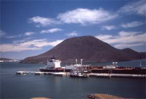
Topolobampo Bay
Commander George Dewey sailed a U.S. sloop-of-war into Mexico’s Topolobampo Bay (shown today) on a surveying mission in 1874.

In 1874, Commander George Dewey sailed the United States sloop-of-war Narragansett into Mexico’s Topolobampo Bay. This was the same George Dewey who, twenty-five years later, defeated the Spanish Navy at Manila Bay after giving his famous command, “You may fire when you are ready, Gridley.”

The mission into Topolobampo was a peaceful one; its goal was to survey the Pacific Coast of Mexico and Baja California. The survey was ordered by President Grant at the behest of Albert Kimsey Owen, a former railroad surveyor and city planner, who had grandiose plans to develop a great harbor at Topolobampo.
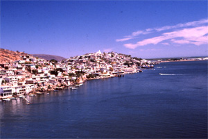
View of Topolobampo Bay.
Topolobampo, 15 miles west of Los Mochis, was the site of a 19th century utopian colony.

The harbor was only part of his plans. A railroad would be built from Topolobampo through Mexico and the United States to the Atlantic Ocean, facilitating trade between Europe, the United States, and the Far East. In addition, the area around Topolobampo would be populated with a utopian American colony.

Owen entered into an agreement to purchase 111,000 acres from a local hacienda owner and, with the help of Mexican president Porfirio Diaz, obtained concessions for the railroad and the colony. He then chartered a corporation, Credit Foncier, in New Jersey.
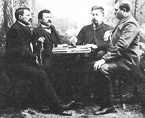
Albert Owen (far left) at Topolobampo.
Albert Kimsey Owen (far left) had grandiose plans to develop a great harbor and a utopian colony at Topolobampo.

People buying stock in Credit Foncier received the right to join the colony, which was to be run communally and without the use of money. Work was to be assigned according to each person’s ability, with credits awarded for labor. Individual accumulation of wealth was prohibited. Eight hours of work, eight hours of sleep and eight hours of culture or entertainment were to make up the daily routine. Colonists would build, own, and operate the railroad, telegraphs, banks, and water supply. Capital gained would be reinvested in the colony’s infrastructure.

Credit Foncier clubs sprang up in the United States and Europe. In late 1886 the first 27 colonists arrived from California, and within a short time the population grew to 2,000.

Activities were directed by Owen. A team made daily trips to the Rio Fuerte to gather fresh water. Several towns were founded, connected by paved roads which permitted bicycle travel. Irrigation ditches were dug. A school was opened. Community theater grew, and an Academy of Sciences, with ties to the Smithsonian Institute, was founded.

Governed by the principles of order, industry and courtesy, the colonists attained modest economic success from fishing, farming and hunting. But the colony was growing much faster than Owen had envisioned. It became top heavy—too many planners and not enough workers.

Benjamin Johnson, only 25 years old when he arrived at the colony, challenged Owen’s leadership and focused the colonies efforts toward developing a single cash crop—sugar. He received a concession to build a canal from the Rio Fuerte to what became Los Mochis, then convinced the Mexican government to evict most of the Owen colonists.

Owen left, but continued to work on building the railroad, convincing Arthur E. Stilwell, an American railroad owner, to join with him. In 1900 the Kansas City, Mexico and Orient Railroad, precursor to the Chihuahua al Pacifico line, was chartered. The same year the colony was abandoned, having lasted fourteen years.

Today, travelers flying into Los Mochis to begin their tour of Copper Canyon look down on the huge bay and the endless agricultural land, laid out in neat rectangular plots. Little remains of the Owen Utopia, but the area’s rich farmlands, and the Copper Canyon railroad are the results of his vision.
White Elephant Sale

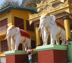
Statues of White Elephants
Statues of White elephants guard the entrance to a temple in Myanmar.

In Myanmar (Burma), the white elephant is highly respected as a symbol of power and prosperity and so it was only natural that a few months ago Myanmar’s government warmly welcomed two newly found white elephants. At the same time, the country was awarded chairmanship of the Association of Southeast Asian Nations for 2014, and U.S. Secretary of State Hillary Clinton’s visit ended 50 years of political isolation from the West. Coincidence? The people in Myanmar don’t think so.

The elephant has for centuries been a symbol of Southeast Asian countries. Maharajas sent them to battle like living tanks, and workmen used them as bulldozers. The rare “white” elephant, though, holds a special place in the lore of these countries.

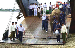
A white elephant is unloaded
A white elephant is unloaded from a transport to take its place of honor near a temple in Myanmar.

While other elephants worked hard, white elephants were cherished by kings, kept in palaces, cared for by senior officials, and worried over constantly. Possession of these sacred beasts was very important. A king who had many white elephants would reign for a long time and his kingdom would prosper. If his white elephants died, it was an omen of disaster for the kingdom.

Burmese kings would hunt for these special beasts, and would present them to each other as marks of diplomacy. Sometimes they fought over them, but they always took great care of them—their rule depended on it.

As elephants were used less and less in warfare, elephant hunts became less common, and fewer white elephants were discovered. In Siam (now Thailand), the King decreed that any white elephant found must be given to him and he offered rewards for their discovery. Each time a white elephant was found, it was cause for public celebration.

When King Mongkut of Siam heard that America had no elephants, he offered to send several to President Lincoln, thinking that if conditions were right they would multiply and Americans would be able to “tame and use them as beasts of burden, making them of benefit to the country.” The President replied that the American climate was probably unsuitable, and Americans preferred to use steam power, but he thanked the king for his gift of two magnificent tusks.

Brahman texts list attributes which must be met to qualify the animal as a true “white” elephant—pearl eyes (the animal is usually an albino), white hoofs, a back which hangs down like the bough of a banana tree, white hairs on the body and tail, and ears which are larger than a regular elephant’s.

Today, in Laos, Cambodia, Viet Nam and Thailand, white elephants are pretty much nonexistent. In Myanmar, with the two new white elephants, the country now has at least five. They are considered sacred, and treated with the utmost respect and care. At certain times of the day, the public may view the elephants. No photos are allowed.

With its new found popularity, Myanmar is on its way to becoming a major tourist destination. Tourist numbers are going up and so are prices. Now is the time to visit this fascinating country while it is still pristine and take advantage of The California Native’s “White Elephant” Sale.

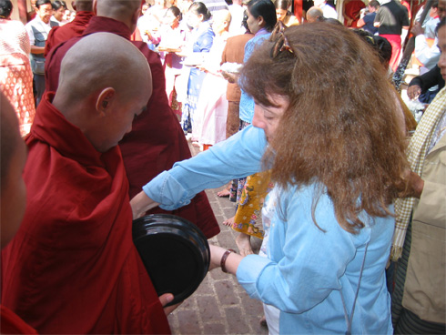
California Native, Ellen Klein, serving rice to monks in Myanmar.

Lonesome George, the Rarest Creature in the World, is No More

Last week, Lonesome George, considered the rarest creature on Earth because he was the last member of his species, died. George was a giant tortoise of a species found only on Pinta Island in the Galápagos. For the last forty years he has been living on Santa Cruz Island at the Darwin Research center. He was estimated to be around 100 years old, young for a Galápagos tortoise which sometimes live past the age of 200. Over the years attempts were made to breed him with females of closely related species but he never found a lady tortoise that interested him.

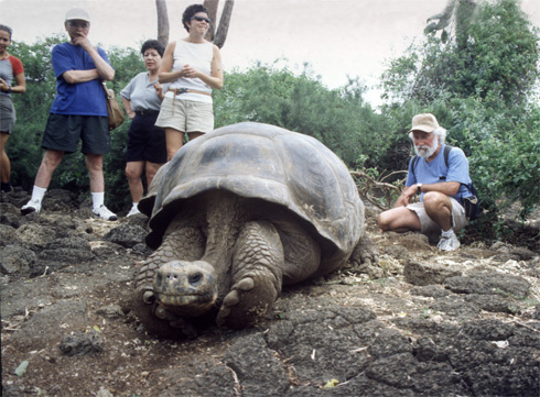
Lonesome George, the last of his species.
The California Native's Lee Klein (right) and guests visit Lonesome George.

The Galápagos Islands, home to the giant tortoises and many other unique species were first discovered in 1535 by Tomas de Berlanga, the bishop of Panama, when his ship drifted off course while on its way to Peru. He named the Islands Las Encantadas, “The Enchanted,” and marveled at the thousands of giant tortoises living there. Because of these tortoises, the Islands became known as the Galápagos—the Spanish word for tortoise.

Sailors—explorers, pirates and whalers, saw the huge tortoises, which weigh up to 550 pounds, as a convenient source of fresh meat, for the tortoises can survive long periods of time without food or water, and can live in the hold of a ship for up to a year. When British naturalist Charles Darwin visited the Galápagos in 1835, aboard the HMS Beagle, the islands’ residents showed him how to tell which island a tortoise belonged to by the shape of its shell. Pondering the causes for this localized diversity led Darwin to develop his Theory of Evolution.

At the time of his visit there were around a quarter of a million tortoises living on the islands. Today less than 15,000 remain. Of the original 15 subspecies, only eleven are left—three have become extinct and the fourth has only one individual left. Thousands of the animals were slaughtered by the crews of sailing ships and, when the islands were colonized in 1832, pigs, goats, rats and other animals also arrived, eating eggs and young tortoises and destroying nests and food supplies.

It is believed that the tortoises, who can float on the sea for several days, came to the Galapagos from the South American mainland. Once on the islands they encountered no enemies. Each of the islands presented its own unique environmental challenges, and the isolated tortoises evolved to take advantage of these differences—tortoises on islands with taller vegetation have longer necks.

Because of the tortoises extreme longevity, visitors to the Islands may unknowingly photograph some of the same tortoises that Darwin himself observed back in 1835.

Nazca’s Ancient Images Continue to Perplex

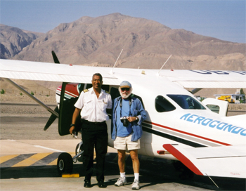
California Native founder, Lee Klein, and Peruvian pilot return from another flight over the ancient Nazca lines.
In the arid desert of Peru, California Native founder, Lee Klein, and Peruvian pilot return from another flight over the ancient Nazca lines. The giant figures and geometric patterns were unknown in the modern world until they were spotted by aircraft in the 1930's.

As our Cessna again circled over the giant figures on the ground I shot the final slide on my roll of film and, leaning at a 45 degree angle, attempted to reload my camera. Another pass over a monkey larger than a football field and we headed back to the dirt landing strip on Peru’s Nazca Desert. This was my first trip to Nazca, and the year was 1979.

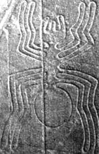
The Nazca Desert is a high arid plateau which stretches 37 miles between the towns of Nazca and Palpa in southern Peru. Hundreds of square miles of this dry, rocky plain are marked with lines, triangles and other geometric shapes, some running for more than five miles in a straight line. There are also giant drawings including a monkey, a spider, birds, reptiles, and whales.

A giant spider on the Nazca Plain
A giant spider the size of half a football field sprawls on the Nazca Plain.

The desert markings, believed to have been made thousands of years ago, made little impression on occasional travelers who viewed them from ground level, but when they were spotted by aircraft in the 1930’s they caught the world’s attention. They have since been surveyed, mapped and studied. Only two questions remain—who made them, and why?

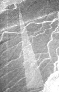
In his 1968 book, “Chariots of the Gods,” Swiss writer Eric von Daniken suggested that the lines were built by “ancient astronauts” as a landing field. Looking at the lines from the sky they do resemble an airport, but it doesn’t seem reasonable that advanced extraterrestrial spacecraft would require landing strips. Besides, Nazca’s soft, sandy soil is hardly suitable for an airport. Forgetting the “Twilight Zone” theories, we can imagine a more down to earth explanation. We know that the region has been inhabited for thousands of years—by the Paracas, 900–200 BC, by the Nazcas, 200 BC–600 AD, and by others. The figures are generally attributed to the Nazcas since they resemble those on Nazca pottery.

From the sky, this wedged shape figure resembles a landing strip.
From the sky, this wedged shape figure at Nazca resembles a landing strip.

But why create figures which can be seen only from the sky? A reasonable explanation is that they were not intended to be viewed by humans but by gods. A local school teacher in the area explained his theory to me. The lines all point toward the Andes—the source of the water which flows into the area through underground aquifers. The figures, he believed, represent the bounty made possible by this water. The Indians probably conducted rituals on these giant drawings to thank the gods and ensure that the water would continue to flow.

They created the lines that extend for miles by placing two stakes in a row, sighting along them to place a third stake, then repeating the process. By moving the desert’s stones and scraping its surface coating, in the absence of rain, the lines have survived the centuries. Hopefully, they will survive many more centuries for future generations to marvel at.

Not far from the lines is the ancient Nazca cemetery at Chauchilla. The Nazcas buried their dead, along with many of their possessions, in underground vaults lined with mud bricks. The bodies were dressed in embroidered cotton clothes, placed in a fetal position, and coated with resin. The hot, dry climate mummified the bodies. Over the centuries the tombs were looted by huaqueros, grave robbers, who located the chambers by sticking poles into the ground.

On my first visit to the site, the scene was of a desolate desert, pockmarked with holes, and littered with human skulls and bones, broken pottery, with colored designs still vivid on their surfaces, and strands of mummy-cloth blowing in the wind. No other person was there except for the Peruvian school teacher, who was my guide, and two German tourists. While the Peruvian and I talked, the Germans were busy stuffing skulls into their backpacks for souvenirs.

Now, more than thirty years later, things are different at the ancient cemetery. The desecrated graves are roped off and trails lead to observation kiosks where mummies and artifacts are displayed. The two German tourists would no longer be able to take a long-deceased Nazcan home with them.

Where Else Can I Travel With The California Native?

We appreciate it when our guests share their stories with us and allow us to post them on our blog. Jim Whilden, from Bethleham, Pennsylvania, just returned from his Yucatan Adventure and had this to report:

Everything worked exactly as it should have. It is always great to be met at the airport by someone who is expecting you and can speak your language! When that occurs the trip is always great. Our guide even seemed glad to see us.

Guillermo, the guide, was superb! He not only explained the tourist sites but answered every question about Mexico’s government, areas, culture, language, etc. He helped us find things we read about in our guide books.

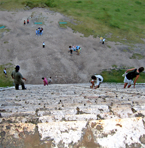
Uxmal, Valladolid, Campeche were wonderful. I loved clinbing the pyramid steps.

The trip really included everything—even specialty shops (ice cream in Merida). The hotels were wonderful and the food was great, especially in the small restaurants and cafes.

Where else can I travel with The California Native?

James G. Whildin, Jr.

It's a long way down from the top of a Mayan pyramid
It's a long way down from the top of a Mayan pyramid on a California Native adventure in Mexico's Yucatan Peninsula.
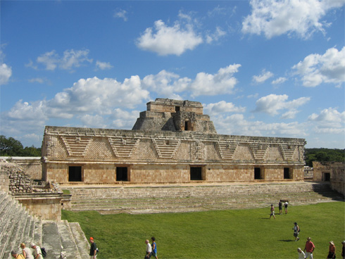
Mayan Ruins at Uxmal
The Nunnery Quadrangle, at the ruins of Uxmal, was named by a 16th-century Spanish priest because it reminded him of a convent in Spain. It may have been a military academy, royal school or palace complex.

The Magic of Machu Picchu

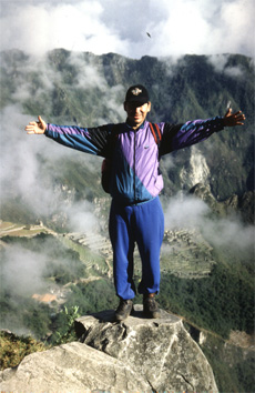
A Peruvian guide stands on a rock overlooking Machu Picchu.
A Peruvian guide stands on a rock overlooking Machu Picchu at the end of the Inca Trail.

We appreciate it when our guests share their stories with us and allow us to post them on our blog. Tom Thiss, from Excelsior, Minnesota, had this to say about his Adventure in Peru and Hiking the Inca Trail:

Machu Picchu cannot be adequately described. One has to experience it, and trekking the trail heightens the anticipation like a good story. The Sun Gate sunrise experience was shrouded in clouds yet for me, it did not matter. What mattered to me at that moment was the euphoria of restored health and energy and the sense of real accomplishment. Machu Picchu’s capacity to evoke the power of imagination not only offsets the “Inca Travail” it supercedes it. This to me is the true testimony of its potency.

Tom Thiss

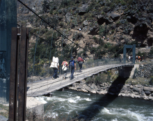
Foot bridge over the Urubamba River is the start of the Inca Trail.

This footbridge over the Urubamba River is the start of the four-day trek on the Inca Trail to Machu Picchu.

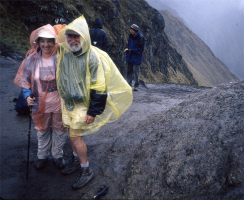
Hikers run into a little rain at "Dead Woman's Pass."

A little rain feels good at “Dead Woman’s Pass,” at 13,860 feet, the highest point on the Inca Trail to Machu Picchu.

30 Years of Adventures With The California Native

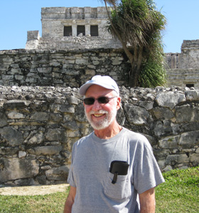
Lee at a Mayan ruin in Mexico's Yucatan.
California native founder, Lee Klein, at a Mayan ruin in Mexico's Yucatan. What a way to make a living.

This June we are celebrating our 30th Anniversary—30 years of leading fantastic trips to exotic destinations around the world.

This anniversary comes as a proud moment for our company’s founder, Lee Klein, who continues to scout new locations world-wide in search of new destinations for the active traveler. Klein, who holds an MBA in Management and a BS in International Marketing, spent more than two decades as a corporate manager and college professor until, in 1983, while climbing Ayer’s Rock in the Australian Outback, he decided to drop out of the corporate world, take off his suit and tie, and create an adventure travel company based on the lessons he taught his students on how to succeed in business: “keep the quality high, keep it affordable, and treat people the way you would like to be treated.”

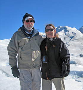
Lee and Ellen on Patagonia's Perito Moreno Glacier.
Lee and Ellen Klein hiking on Patagonia's Perito Moreno Glacier.

The initial offering from The California Native was a tour billed as “The Other Los Angeles.” This day-long excursion traced the route of the San Andreas Fault from the Mojave Desert to the San Gabriel Mountains without ever leaving Los Angeles County. The tours became so popular that colleges in three California counties offered them as part of their community-education programs. From this, the company expanded its offerings to include tours to the Channel Islands, Death Valley, Yosemite, and other uniquely California destinations, as well as white-water rafting, ballooning, spelunking (caving), sailplane gliding, and other outdoor adventures. “My family has lived in Los Angeles for generations,” writes Klein in the company newsletter, “hence the name The California Native.”

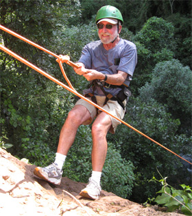
California Native founder, Lee Klein, rappelling in Argentina
Lee rappelling in Argentina. Hey, this is research.

Satisfying the growing client base led to the development of The California Native’s most popular destination—Mexico’s Copper Canyon. These escorted and independent tours feature the Chihuahua al Pacifico Railroad (labeled as one of the most spectacular train rides in the western hemisphere) and highlight one of the most primitive indigenous cultures still subsisting in North America—the Tarahumara Indians. The California Native has become a leading source of information on this remote area and the company and it’s guides are known throughout the area for their work with the Tarahumara.

Today, The California Native offers a wide selection of tours to destinations including Costa Rica, Yucatan, Patagonia, Peru, the Galapagos, Ireland, Bhutan, Myanmar, and China, and more destinations are in the planning stages.

A Wonderful Time in Copper Canyon

We appreciate it when our guests share their stories with us and allow us to post them on our blog. This last February David & Stephani White, from Wilsonville, Oregon, traveled with us on our Copper Canyon 8-day Independent Trip to the Canyon Bottom.

A Young Tarahumara Lady Weaves a Basket
A young Tarahumara lady weaves a basket in Mexico's Copper Canyon.

My wife and I took the 8-day to the bottom trip in February of this year. I have been meaning to write , but ….

We had a wonderful time. The hotel in El Fuerte was terrific. The train trip was fascinating and beautiful. We really enjoyed Batopilas. Julio, our guide, was very knowledgeable, helpful, and fun to be with. We had a special treat: government aid distribution took place in Batopilas while we were there. The town square filled with over 200 Tarahumara people in their colorful clothing to receive drought-assistance. The hotel at Divisidero is stunning.

Thank you very much. It was a wonderful trip. Hopefully our enthusiastic recommendations to our friends will bring more business.

David & Stephani White

Copper Canyon’s Gringo Runner

The Tarahumara Indians of Mexico’s Copper Canyon have long been acknowledged as the world’s greatest long distance runners. Their reputation was recently popularized by the May 2009 publication of Christopher McDougall’s book “Born to Run.” Much of the book focuses on the exploits of Micah True, an American runner who spent a good deal of time running with the Tarahumara and founding the Copper Canyon ultra-marathon race in the bottom of the canyon. In March of 2012 True, known in the canyons as “Caballo Blanco,” died on a solo run in New Mexico’s Gila Wilderness. As a tribute to True, we asked our good friend Doug Rhodes, an American outdoor adventurer, owner of Copper Canyon’s Paraiso del Oso Lodge and long-time resident of Mexico’s Sierra Madre, to share some of his memories of “Caballo Blanco” with us.

The following is a collection of a remembrances, sort of the way Micah was, all jumbled up.

Riding my mule towards Batopilas many years back, I encountered a goofy looking gringo wearing running shorts about the size of my bandanna. Bare-chested and running in the hot sun, my suspicions of this guy’s sanity were confirmed when he introduced himself as the “Caballo Blanco” (White Horse) and let out a whinny to prove it. Little did I realize then that guy and I would share trails, tears, and experiences and that we would become friends, indeed, more than friends.

One of my favorite recollections is when he asked to join us heading to our ranch at Los Alisos from Batopilas. We’d just finished a pack trip and had a small herd of horses to take across the mountains. Little did we realize that the lead horse would be this long-legged gringo known as Caballo Blanco. Now, our prize Appaloosa “Andy” is the Alpha or lead horse of the pack, a critter not known to take second place to anyone. Imagine our surprise when Andy fell in behind Micah, trotting down the trail with Micah in the lead, Andy right behind Micah and all the other horses trotting behind them. Micah kept looking back over his shoulder at the pack. When he zigged, the horses zigged as they did when he zagged or slowed down. It was an unbelievable sight; we nearly fell out of our saddles laughing.

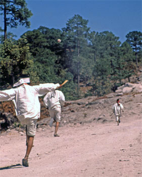
Tarahumara Runners
Tarahumara runners in Mexico's Copper Canyon.

Another time Prospero Torres and I sponsored a faina to work on the trail above Los Alisos. (Note: A faina is a communal work project with food, fermented corn tesguino, and sometimes dancing after the work is finished.) Micah showed up and worked hard all day alongside the Tarahumara men. That night he ate as usual, like a horse. Then the dancing started, Micah could not quite get a hang on the traditional dancing so, as was his habit, he just did his own thing, a sort of 1920s type thing where one places their hands on their knees, brings the knees together and swaps positions of the hands over the knees. His dancing embarrassed the heck out of me but the Tarahumara laughed and loved it. Micah had a way of doing the strangest things and getting people to love him for it.

Back about 2001 or so, Micah got the wild idea of starting a marathon from Urique to Batopilas to get the Tarahumara people running again and, knowing him, just for the fun of it. Several of us helped him out as we could but most of the funding came out of Micah’s pocket and set the trend for future races. Micah never had much; material things seemed not to matter to him, but he shared what he had with friends and for what he believed in and he sure believed in his race.

The May 2009 publication of the book “Born to Run” catapulted both Micah and his race to virtual legendary status.

Doug “Diego” Rhodes

Travelers From Brazil Enjoy Mexico’s Copper Canyon

We appreciate it when our guests share their stories with us and allow us to post them on our blog. A few months ago Doris Beinhauer and Henry Adler from Rio de Janiero, Brazil, traveled with us on our Copper Canyon 11-day Independent Trip to the Canyon Bottom.

Hi Lee, Laurie and all the California Native team,

Just this week we have been talking with friends from Los Angeles about our trip to Copper Canyon and how much we enjoyed it. This little adventure turned out even better than I imagined.

We liked El Fuerte and the Hotel Torres del Fuerte. Chihuahua was also a real surprise.

Highlight of course was the trip from Creel to Batopilas. If we ever would visit again we would like to hike into the canyon, and if there is another time we shall surely contact you.

All the best from Rio de Janeiro,

Doris and Henry

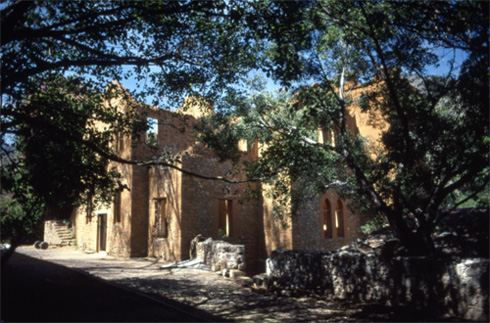
Ruins of the Shepherd Hacienda
In the town of Batopilas, at the bottom of Copper Canyon, the ruins of the Shepherd Hacienda are a reminder of the time when this town was one of the richest silver mining cities in the world.