|
Copper Canyon
Towns and Villages
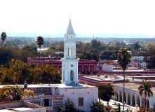
| EL FUERTE: A small colonial town with cobblestone
streets located about 50 miles east of Los Mochis, El Fuerte, “The
Fort,” was founded in 1564 by Spanish Conquistador Don Francisco
de Ibarra as a military post. For three hundred years it served
as a trading post for gold and silver miners. |
 |
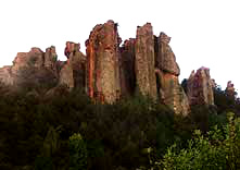
| CEROCAHUI: A small, peaceful farming village of about
600 residents, Cerocahui is located at an altitude of 5000 feet.
The valley is dotted with apple and peach orchards and is surrounded
by the Sierra Madres. A narrow dirt road leads from Cerocahui down
to the village of Urique in the bottom of the Urique Canyon. |
 |
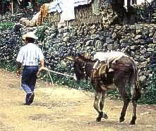
| URIQUE: A small village at the bottom of the canyon, Urique
was founded in 1690. It remained isolated until it was connected
by dirt road to Cerocahui in 1975. Gold mining is still conducted
there on a small scale and the town serves as a county seat and
economic center for this rugged and remote section of the mountains. |
 |
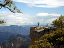
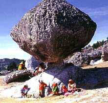
| EL DIVISADERO: “The View Point.” At an altitude
of nearly 8,000 feet, this magnificent vista point overlooks a
whole series of intertwined “barrancas”
(canyons) with rivers deep in their bottoms. This is also the point
where most visitors first encounter the remote and cave-dwelling
Tarahumara Indians. El Divisadero provides many photo opportunities
and short hikes to local caves, a Tarahumara school, balancing
rock, and several dramatic viewpoints. |
 |
| CREEL: Situated at an altitude of approximately 7,200
feet, Creel is a small lumber town located in the high Sierras
close to Copper Canyon. At one point the terminus of the Chihuahua
al Pacifico rail line, Creel is now the midway stopping and departure
point for several Indian villages in the area. From Creel, many
Tarahumara caves can be visited along with beautiful lakes, waterfalls,
pine forests and strange rock formations. |
 |
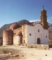
| BATOPILAS: Located at the bottom of Copper Canyon, Batopilas,
now a sleepy little village, was once one of the richest silver
mining areas in the world. A visit to Batopilas is a step back
in time. Cowboys ride their horses down its dirt streets while
Indians pack their burros with supplies for their remote villages.
On the outskirts of the town are the ruins of a Gothic mansion
built in 1880 of adobe by Alexander Shepherd, an American entrepreneur
and the last territorial governor of Washington D.C., and a 400-year-old
Jesuit mission known as the “Lost Cathedral” of Satevo. |
 |
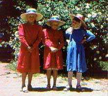
| CUAUHTEMOC: A modern Mexican city, Cuauhtemoc lies en
route to the state capital of Chihuahua. Named after the mighty
Aztec leader, Cuauhtemoc is now the home of several thousand Mennonites
who came to the area shortly after the Mexican Revolution to farm
lands which were formerly owned by William Randolph Hearst. The
Mennonites live in a series of numbered “campos” just
outside of the city and still preserve their traditional pious
lifestyle. They are very prosperous farmers and market their crops
throughout Mexico along with their famous cheese. |
 |
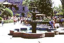
| CHIHUAHUA CITY: Capital of the state of Chihuahua, this
large Mexican city is one of the most important cities in Northern
Mexico. During both the War for Independence and the Mexican Revolution,
Chihuahua was an important center of activity. Father Miguel Hidalgo,
champion of Mexico's Independence, was executed in what now serves
as the government palace. This was also the headquarters for famous
leaders such as Benito Juarez and the Revolution's controversial
hero, Pancho Villa. Here, visits can be made to several interesting
sites, including the Chihuahua State Museum, the home of Pancho
Villa and Museum of the Revolution, and the Chihuahua Cathedral,
which took one hundred years to complete. |
 |
Phone us at:
 |
E-mail us at:
 |
The California Native
6701 W. 87th Place, Los Angeles CA 90045
|
|
|


